NN14 Attendees and others....let me take you back to year 1983 in Detroit and Wayne County in a photo diary about air pollution. Note that most photos are B/W reproduction.
Mostly I'm doing this here to again remind Democrats that they are 100% owners of the environmental protection traditions and accomplishments of Senator Edmund Muskie, who was Democrat's "FDR" on the environment as a party historical, leadership, stewardship and governance icon. Ownership means being responsible for defense of the Clean Air Act and it also means taking credit for past accomplishments on environmental cleanup, including reduction of community air pollution.
While the 1983 pictures show some heavy air pollution, it is important to understand that the amount of air pollution emitted in Detroit and Wayne County in 1983 was very significantly reduced over a far, far worse situation when the Federal Clean Air Act was first adopted in 1970.
Back in 1970, in Wayne County, the entire sky in downriver/Dearborn area would appear rust-colored from heavy uncontrolled particulate emissions from steel plants on Zug Island and in Dearborn. In 1970, air pollution in Wayne County was a extreme, severe problem much, much worse than anything shown or reflected in the 1983 pictures below.
=====
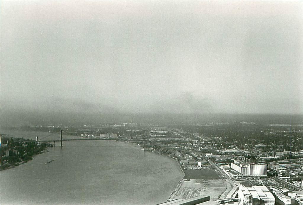
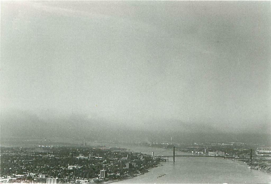
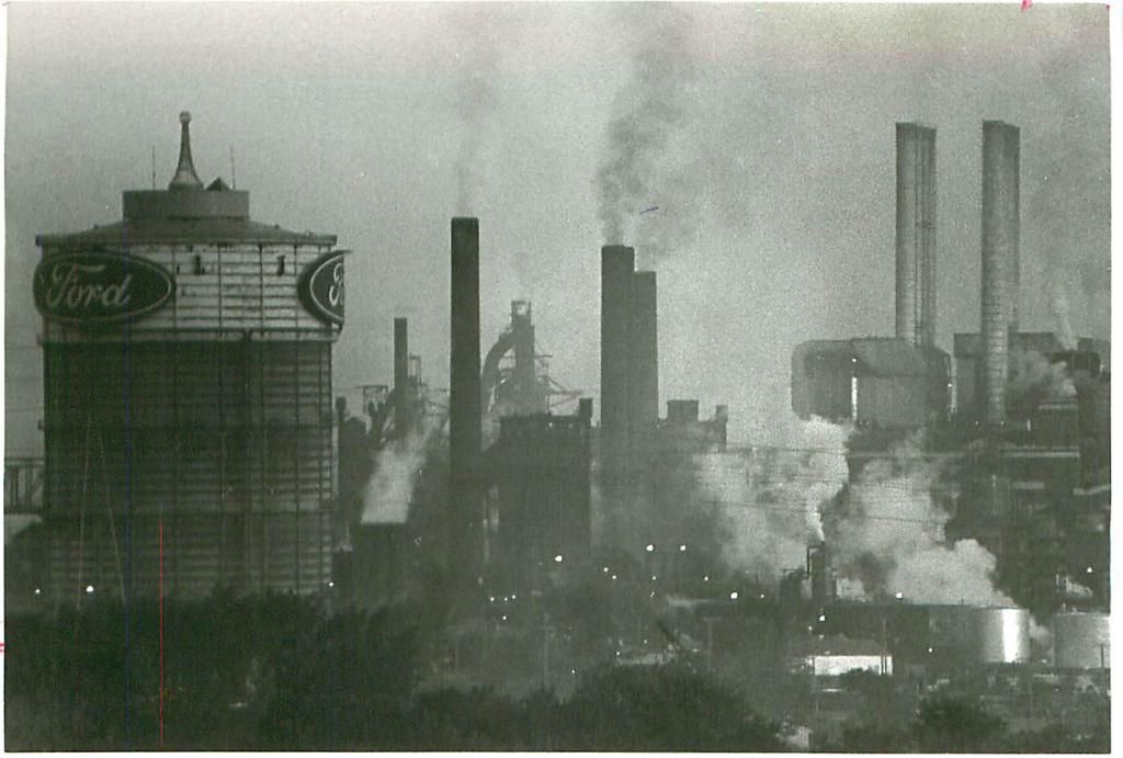
The first group of photos was taken from this vantage point .....yep, I was out on the external roof of the central tower of the Renaissance Center. The management there graciously allowed my American Lung Association air pollution photography.
Back in 1983, both particulate matter and nitrogen oxides would contribute to a heavy regional visible haze layer over the entire metropolitan Detroit area during stable atmospheres (clear sky, light winds, few clouds) which is shown in this view north from the RenCen: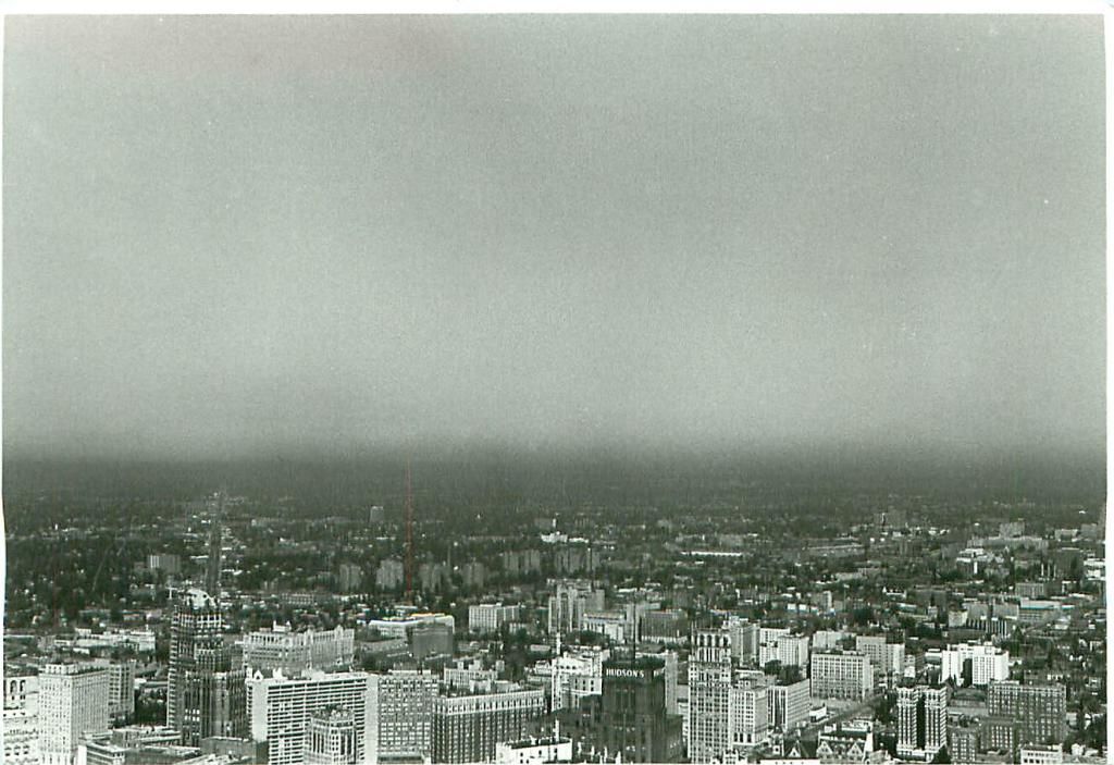
The haze layer looks even more distinct and defined in this view to the Southwest downriver:
However, this view to the south shows another aspect of problems back in 1983 with a significant transboundary air pollution transport problem with Ontario getting heavy exposure from downriver Wayne County air pollution sources.
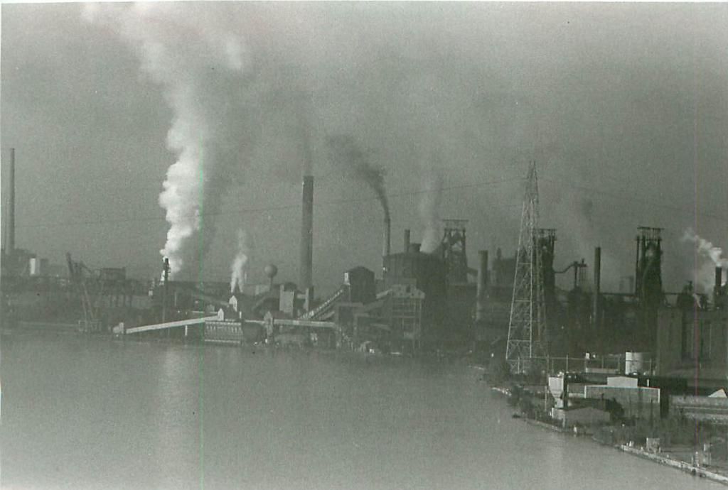
This was taken with a telephoto lens from the west shoulder of Southbound I-75 on the River Rouge bridge and shows coke storage, coke oven batteries and the Rouge complex powerhouse in the foreground and steel furnace equipment further back. Both the coke oven battery and the powerhouse ceased operation years ago, but this site is about 3 blocks from Salina Elementary School in Dearborn.
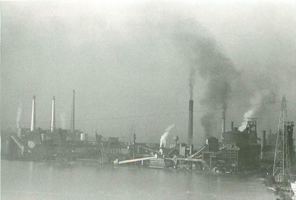
These photos were taken from out on the Ambassador bridge where I walked out to the near middle to set up a tripod with my camera and 300 mm zoom telephoto lens. This view mostly shows National Steel on Zug Island (now U.S. Steel), Detroit coke and also shows the City of Detroit Mistersky power plant.
Here is another view of National Steel on Zug Island, and on the left is Detroit Edison's River Rouge Power plant.
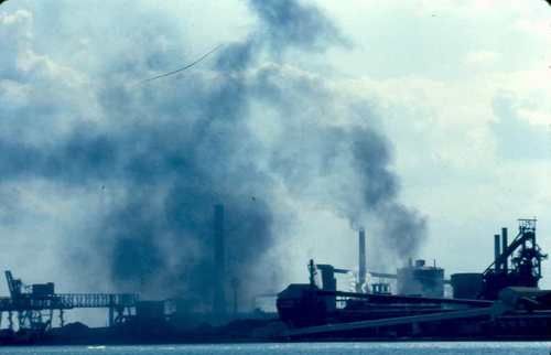
Here are two views of National Steel on Zug Island taken from a closer vantage point:

This last view of Zug Island was taken from Ontario across the Detroit River in 1987:
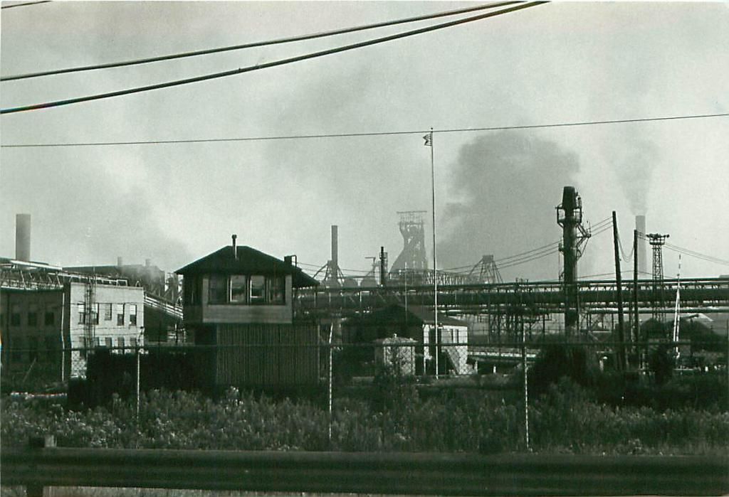
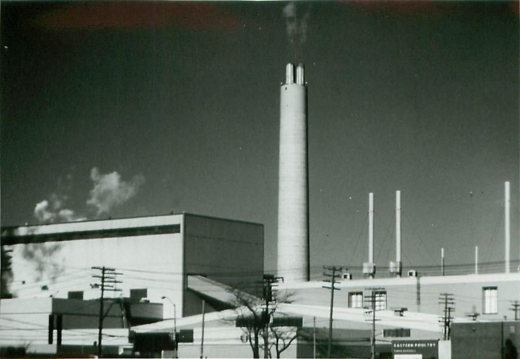
Here is a view of the Detroit Incinerator about 1986, before getting into an air pollution control wrestling match with Mayor Coleman Young that eventually led to replacement and extensive revision of all of the air pollution control equipment on what was then a newly constructed plant without best available control technology being installed. The Detroit Incinerator is located less than a half mile east of the
Detroit Art Institute [go see the Diego Rivera Room at the DAI while you're here]:
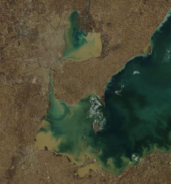
My final photo is not an air pollution photo and it isn't from 1983, but from 2009. This is a water quality photo showing extensive turbidity from rivers entering the Lake St. Clair/Detroit River/Lake Erie system....which mostly arises from Michigan, Ohio and Ontario agricultural operations: